Scientists just released a map of all 2.75 billion buildings on Earth, in 3D
Scientists have created the first complete 3D map of every building on Earth, a total of 2.75 billion structures.
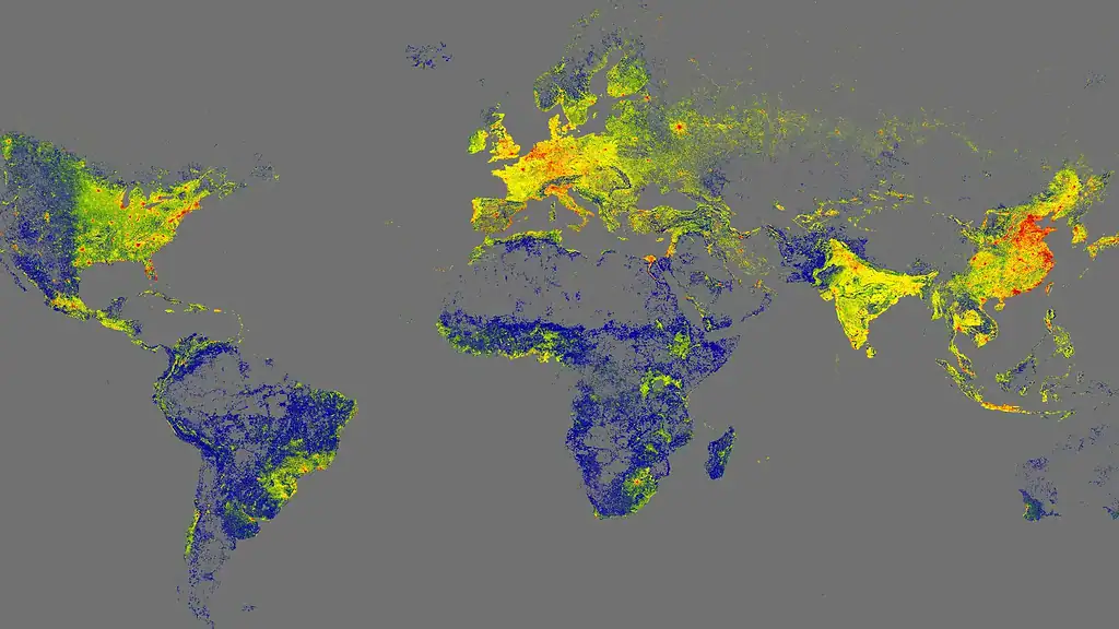
Researchers at the Technical University of Munich have launched the GlobalBuildingAtlas, a high-resolution model built from satellite imagery collected since 2019. The atlas shows where people live and how buildings are distributed across the planet, capturing each structure in a 3 by 3 meter model that reveals its height, shape, and volume.
Prof. Xiaoxiang Zhu, who leads the Chair of Data Science in Earth Observation at TUM, said that 3D models offer more precise insights into global living conditions. Earlier maps identified about 1.7 billion buildings, so this project significantly expands coverage and provides data at thirty times the resolution of previous efforts. Ninety seven percent of the mapped buildings appear as simplified LoD1 models that record both geometry and elevation.
The atlas is open to the public. Anyone can zoom from a global view down to individual neighborhoods, including remote rural areas, and even search by address to see building locations and elevation.
This dataset offers a new way to examine human activity. According to Zhu, 3D building information gives a clearer picture of urbanization and poverty than traditional maps. The team introduced a new metric called building volume per capita, which measures how much built space exists relative to population. Wealthier regions tend to show more building volume per person, while low income and high density areas show far less. This ratio highlights inequality and varying living standards across the world.
Governments and humanitarian organizations can use the data to identify areas with housing shortages, infrastructure strain, or fast growing informal settlements. Zhu said the atlas provides a precise foundation for planning and monitoring urban development and helps cities take targeted action to improve living conditions.
To address long standing data gaps, the team made global coverage a priority. Their algorithms filled missing areas in regions that previously lacked good satellite data, especially in Africa, South America, and Southeast Asia. The result is a more complete and balanced view that includes both major cities and rural landscapes worldwide.
The dataset also has implications for climate research. Buildings account for nearly forty percent of global carbon emissions, and detailed knowledge of building size and density can improve energy and climate modeling.
The GlobalBuildingAtlas comes at a time of rapid global urbanization. By 2050, about seventy percent of the world’s population will live in cities. Researchers hope the atlas will support decisions about how to manage that growth. The data and code are publicly available on GitHub, allowing anyone to explore or analyze the information.
Zhu said future work will involve adding time-based data to show how cities expand, change, or decline.