
Cumbria Braced For Snow As Met Office Issues Yellow Weather Warning
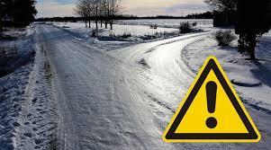
Cumbria is facing potential snowfall and travel disruption as forecasters warn that colder conditions could bring significant snow to higher parts of the county.
The Met Office has issued a yellow weather warning covering Cumbria from midnight until 11am on Tuesday, 17 November. The warning highlights the possibility of difficult travelling conditions, particularly across elevated routes and exposed areas. A band of rain moving northwards across the country is expected to encounter colder air overnight, causing precipitation to turn into snow for a period during the early hours and morning.
The greatest risk of snowfall is expected in locations approximately 100 metres above sea level and higher. Forecasters expect accumulations of between 1cm and 5cm in areas where snow settles, while locations above 300 to 400 metres could receive between 5cm and 15cm. Lower-lying areas are less likely to experience lasting snowfall, with any accumulation expected to be temporary and melt relatively quickly.
The warning raises concerns about journeys across the Lake District and other elevated parts of Cumbria, where snow and strong easterly winds could combine to create challenging conditions. Localised drifting is possible on exposed routes, potentially making some roads more difficult to navigate. Drivers travelling through upland areas have been advised to allow additional time and check conditions before beginning their journeys.
Public transport could also experience disruption during the warning period. The Met Office has warned that some roads and railway lines are likely to be affected, potentially resulting in longer journey times for motorists, bus passengers and rail users. There is also a small possibility of interruptions to electricity supplies and reduced mobile phone services in affected locations, particularly where ice accumulates on infrastructure such as power lines.
Forecasters expect the snowfall to gradually turn back into rain as milder conditions move northwards through Tuesday morning. The transition is expected to happen progressively, meaning some higher routes could continue experiencing wintry conditions even as lower areas see rainfall. Surface water could also create additional localised disruption as the weather system moves through the region.
The snow warning follows a separate yellow alert for ice that affected Cumbria and other parts of northern Britain. That warning covered the period from Sunday evening, 15 November, until Monday morning, 16 November, after rain and hill snow were followed by clearing skies and temperatures falling below freezing. Untreated roads, pavements and cycle paths were identified as areas where slippery conditions could develop.
The Met Office has advised motorists to plan journeys carefully, check for road closures and public transport delays, and leave extra time when travelling during periods of wintry weather. Drivers are also encouraged to carry essential supplies, including warm clothing, food, water, a torch and an ice scraper. Pedestrians and cyclists should take additional care on untreated surfaces, particularly in areas exposed to freezing temperatures.
Residents across Cumbria are being encouraged to monitor updated forecasts and official weather warnings as conditions develop. Although the yellow alert does not indicate widespread severe snowfall across the entire county, higher ground faces a greater possibility of disruption. The latest warning information and local travel updates will help motorists, commuters and other residents prepare for changing conditions throughout Tuesday morning.
For further local news, community updates and story tips, contact news@lakelandpost.co.uk or 0333 090 2080.